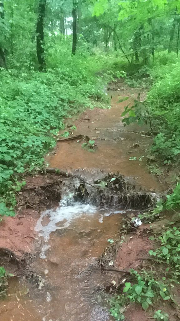
After 2½ years of working with the county on this, they have at last come back with a proposed design plan for retrofitting the existing swale. Here are the details:
- The county will retrofit and subsequently assume responsibility for the existing swale from top to bottom (i.e., the entire length, hurray!). We will consequently need to grant them a maximum 20-ft wide easement to do so (more about granting them this easement below).
- They will extend and alter the drainpipe that empties into Parcel F from behind #13 Barnswallow Court (Lot 138) to change the direction of the flow into the existing channel, and enclose this alteration with a manhole. (This pipe has been the source of all our flooding problems, so the fact that they are actually changing the outflow direction of it is fantastic!)
- They will re-grade and widen the existing channel to a maximum of 12 ft (it is currently a max of 10 ft wide), gently sloping the sides, and lay down an erosion preventative material over the entire graded area. This will help stabilize the channel and keep sediment from piling up at the bottom end. (Erosion and sediment build up has become another big problem with the current swale.) The material they intend to use is called Flexamat. You can read about it and see pictures of it here. It will allow some vegetation to grow up through it and animals and people can easily walk on it.
- The newly-widened channel will continue to reside completely on common ground. No portion will cross over onto homeowner property, although the outer edge of the channel may come right up against a few private property lines. No private property fences, however, will be disturbed.
- The channel bottom will be approximately 4 ft wide (it is currently a maximum of 6 ft wide, shallow in some spots, deeply eroded in others). The anticipated minimum and maximum depth of the retrofitted channel will be 1.75 ft to 2 ft (this is channel bottom to top of slope).
Please take a look at their Proposed Design Plan for Cardinal Glen Parcel F Swale.
They’ve assured us that they have run repeated virtual simulations with this design using flood water storm conditions (and not just that once-in-a-100-year flood rainfall) and are confident that water will no longer jump the banks regardless of how many flooding rainfalls we get in single season. The project engineer we’ve been working with has listened and been extremely responsive to my concerns, and we actually have confidence the county is not going to mess this up. Not only that, but apparently the county and the storm water management department is going to get big kudos from the state if they do this correctly.
If the HOA board votes to proceed, the next step is to provide the county with a letter stating we give them permission to file for an easement (i.e., they take care of filling out and filing the actual easement request; all the board will need to do is review and sign it). The county does all the rest, including paying any fees associated with the filing. Construction will take place this coming summer and we will be on-site overseeing it from beginning to end.
There are some things about this construction you need to know:
- The construction required for this retrofit will necessitate the use of some heavy machinery. I will take care of contacting all the homeowners whose property borders Parcel F to alert them to the construction and ensuing noise.
- As shown by the broken red lines in the attached Proposed Design Plan, the maximum width (the limit of disturbance) of the area in Parcel F that may be needed for the retrofit will be approximately 50 ft. This limit of disturbance encompasses both sides of the existing channel (i.e., not 50 ft on each side of the existing channel).
- Since Parcel F is heavily wooded, certain trees, identified by the colored circles inside the broken red lines in the Plan, may need to be taken down.
- Every effort will be made by the County and its construction team to remove only those circled trees which are truly a channel obstruction and/or which cannot be maneuvered around by the construction machinery. Hence, the maximum width of the limit of disturbance may be wider in some spots to help save trees. (I have already walked the existing swale with the project engineer and we have discussed each tree that is circled and which of these might be saved.)
- The cost of felling these trees and removing of all branches and trunks from Parcel F will be borne completely by the County.
- As stated in #3. on pages 3-4 of the Example Storm Drain Easement Grant, the county will purchase and plant replacement trees at their cost if we so desire.